Regional Operational Ocean Forecast for New York Bight
A self-operated ROMS regional ocean forecast system for the New York Bight, running a daily 5-day forecast cycle for surface currents, water level, temperature, and salinity, with skill checked against NOAA tide gauges.
The Challenge
Operating a forecast system is a different test than building the model itself. The daily cycle — forcing data ingestion, model execution, quality checks, and report generation — has to run reliably every day, and the forecasts have to be checked against what the ocean actually did, not just judged as plausible-looking.
The Approach
Run a ROMS configuration for the New York Bight (Long Island Sound through the New York/New Jersey shelf) on a rolling 5-day forecast cycle, ingesting atmospheric forcing and open-boundary/tidal conditions to generate forecasts of surface currents, water level, temperature, and salinity, and checking each cycle’s water-level forecast against NOAA CO-OPS tide gauge observations at Sandy Hook, NJ and Montauk, NY.
The Result
The system runs a daily operational cycle whose water-level forecasts track the CO-OPS tide gauge record closely — correlation of 0.95 at Sandy Hook and 0.90 at Montauk — with comparable current skill (R of 0.88-0.89 against an NDBC buoy at Barnegat, NJ) and more mixed sea-surface temperature skill (R of 0.12-0.65 across five stations), tracked daily in the report below.
Same underlying capability as the Regional Ocean Forecast System (ROMS) product, now configured for the New York Bight and run independently as a self-directed operational project.
Daily Forecast Report
Each daily cycle runs a 5-day forecast on a curvilinear ROMS grid (200×85 rho points) spanning Long Island Sound through the New York/New Jersey shelf, and compiles the results into a report covering:
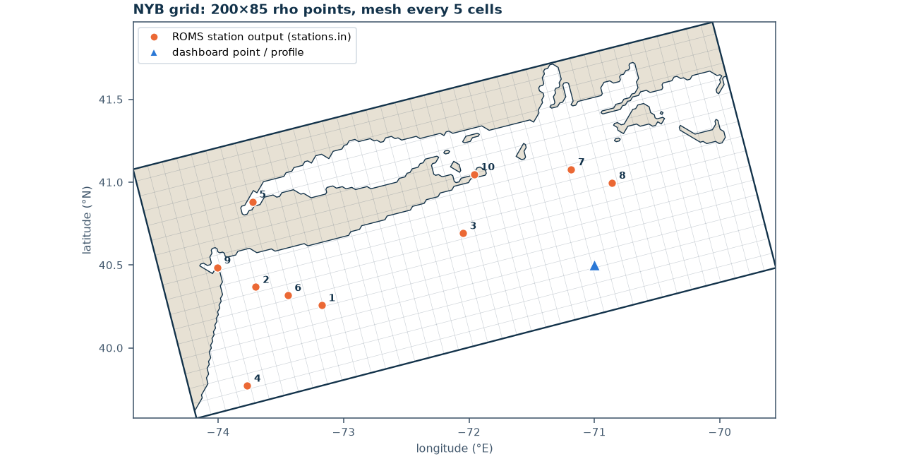 Model domain and grid — the curvilinear ROMS mesh used for the forecast, with output station locations marked.
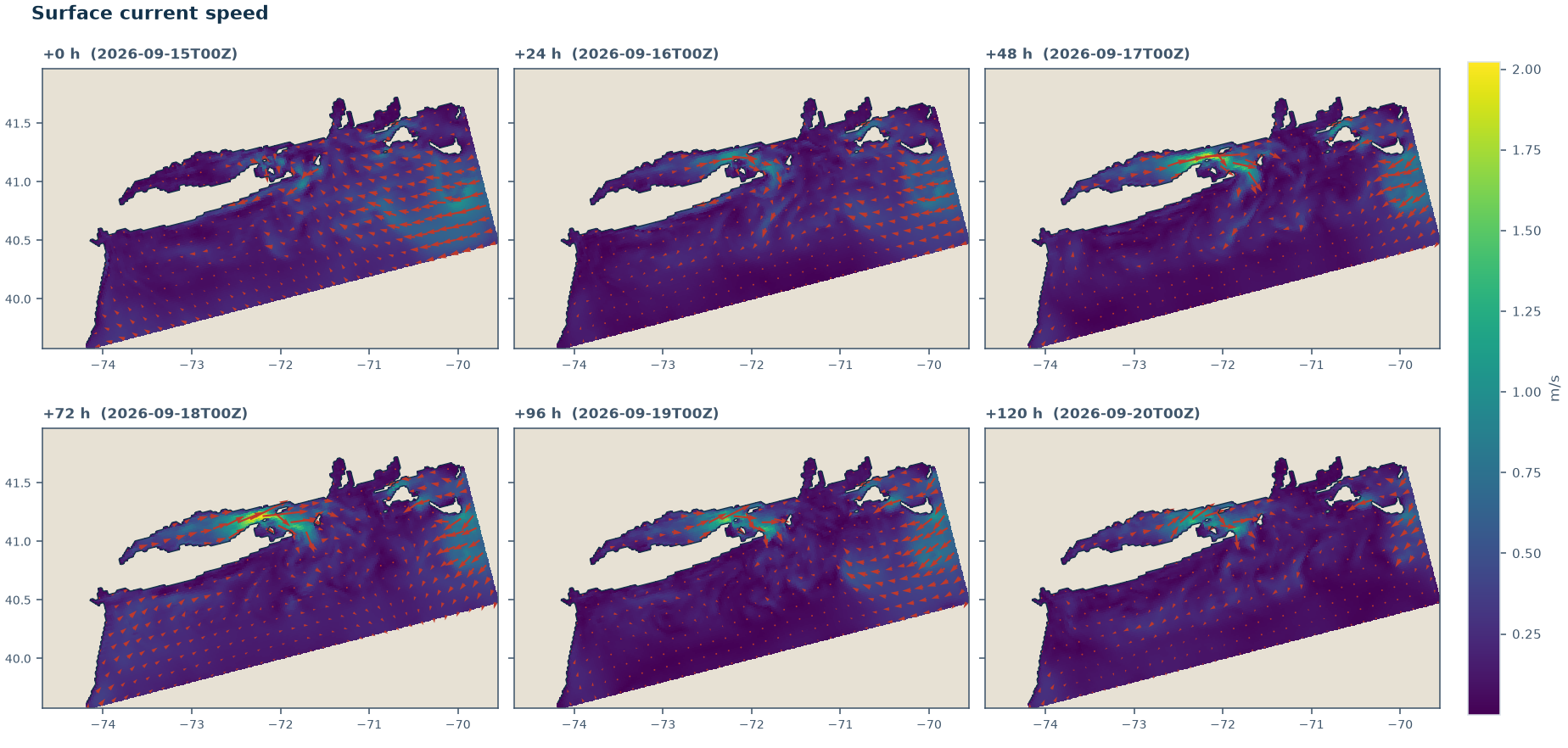
Surface current speed and direction, forecast out to 120 hours (5 days) in 24-hour steps.
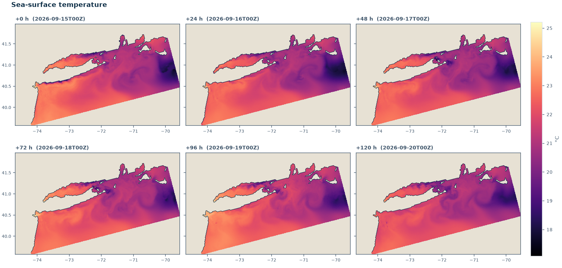 Sea-surface temperature over the same 5-day forecast window.
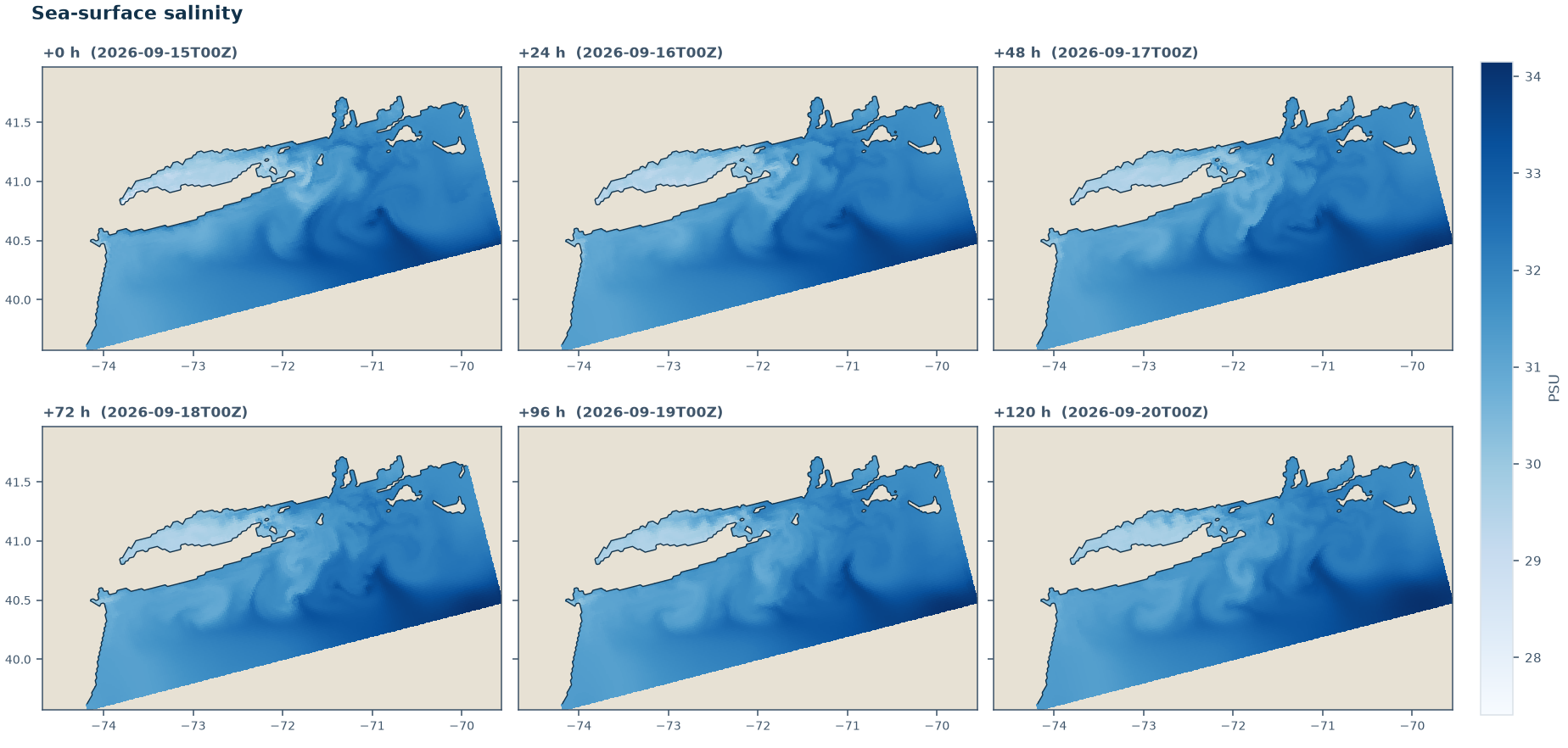 Sea-surface salinity over the same 5-day forecast window.
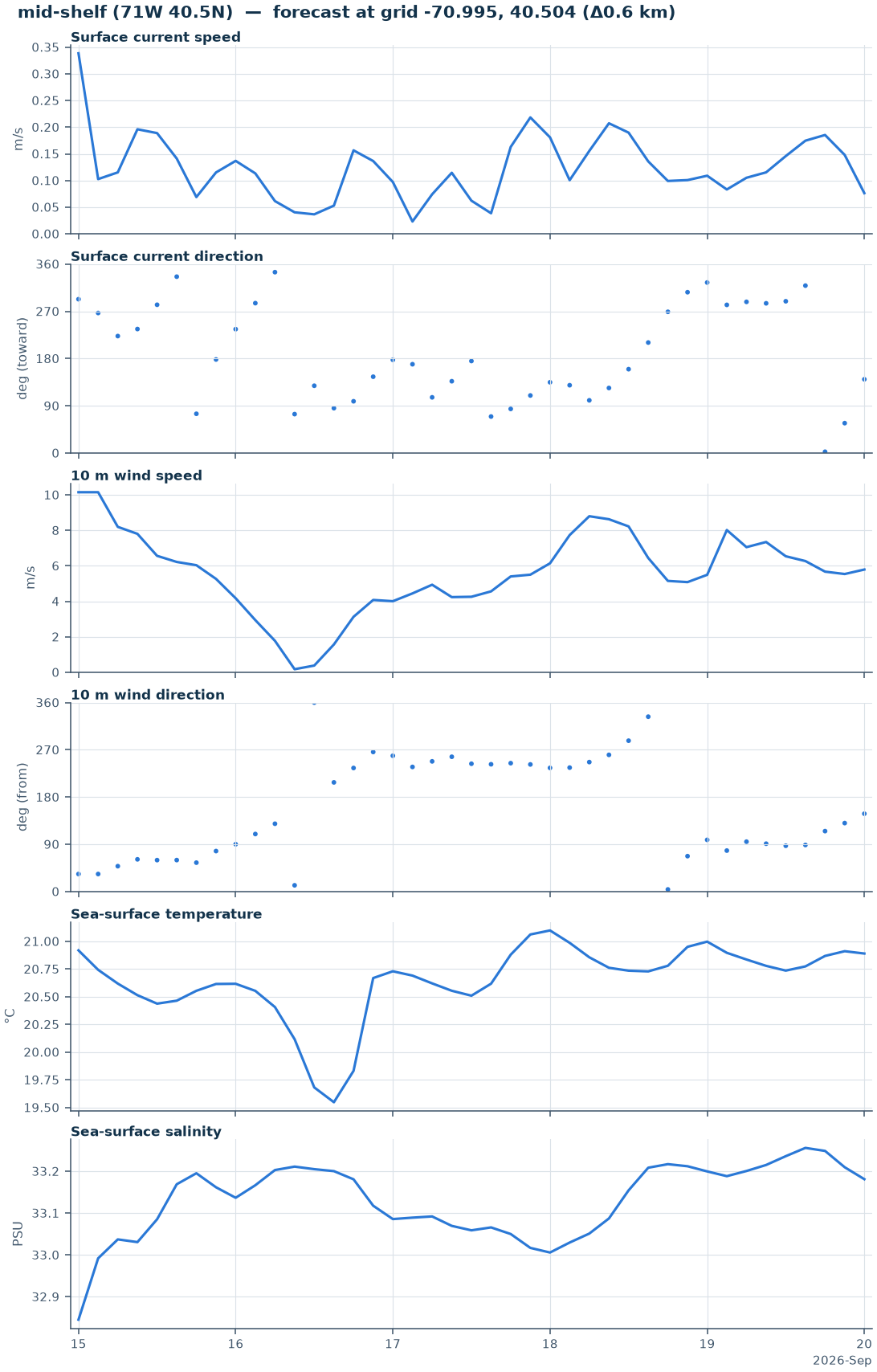 Point forecast time series at a mid-shelf location — currents, wind, temperature, and salinity through the forecast window.
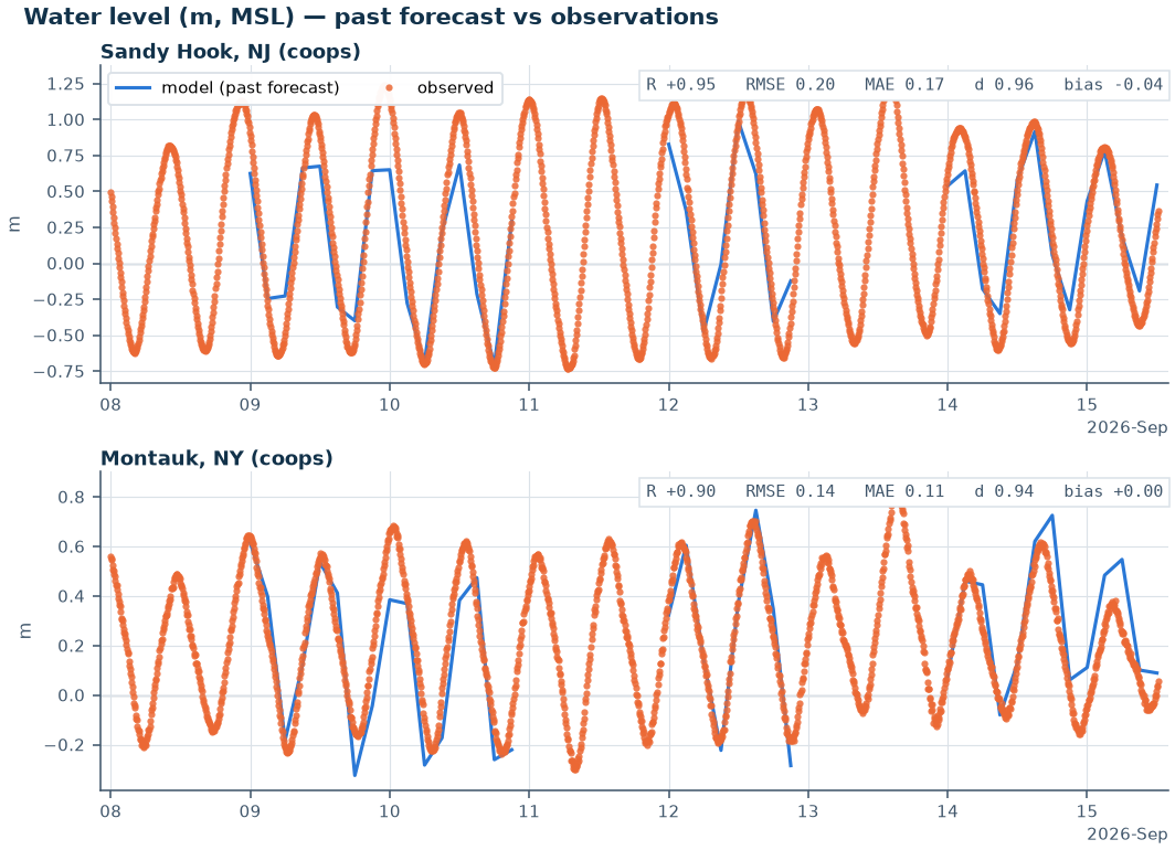 Daily skill check — modeled water level against NOAA CO-OPS tide gauge observations at Sandy Hook, NJ and Montauk, NY.
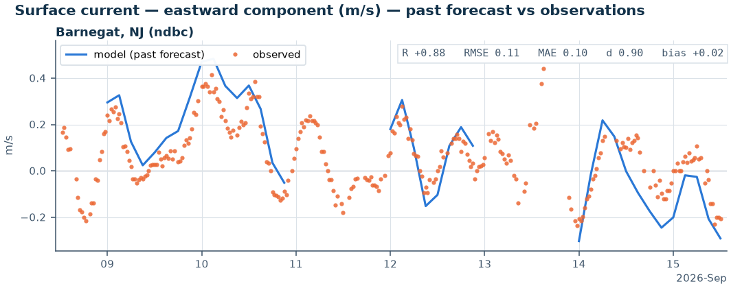 Daily skill check — modeled surface current (eastward component) against an NDBC buoy at Barnegat, NJ: R = 0.88, RMSE = 0.11 m/s.
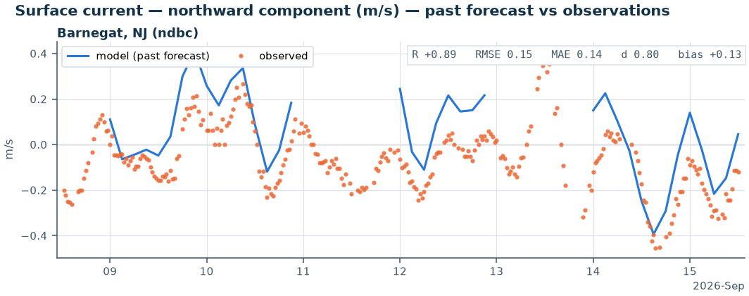 Daily skill check — modeled surface current (northward component), same station: R = 0.89, RMSE = 0.15 m/s.
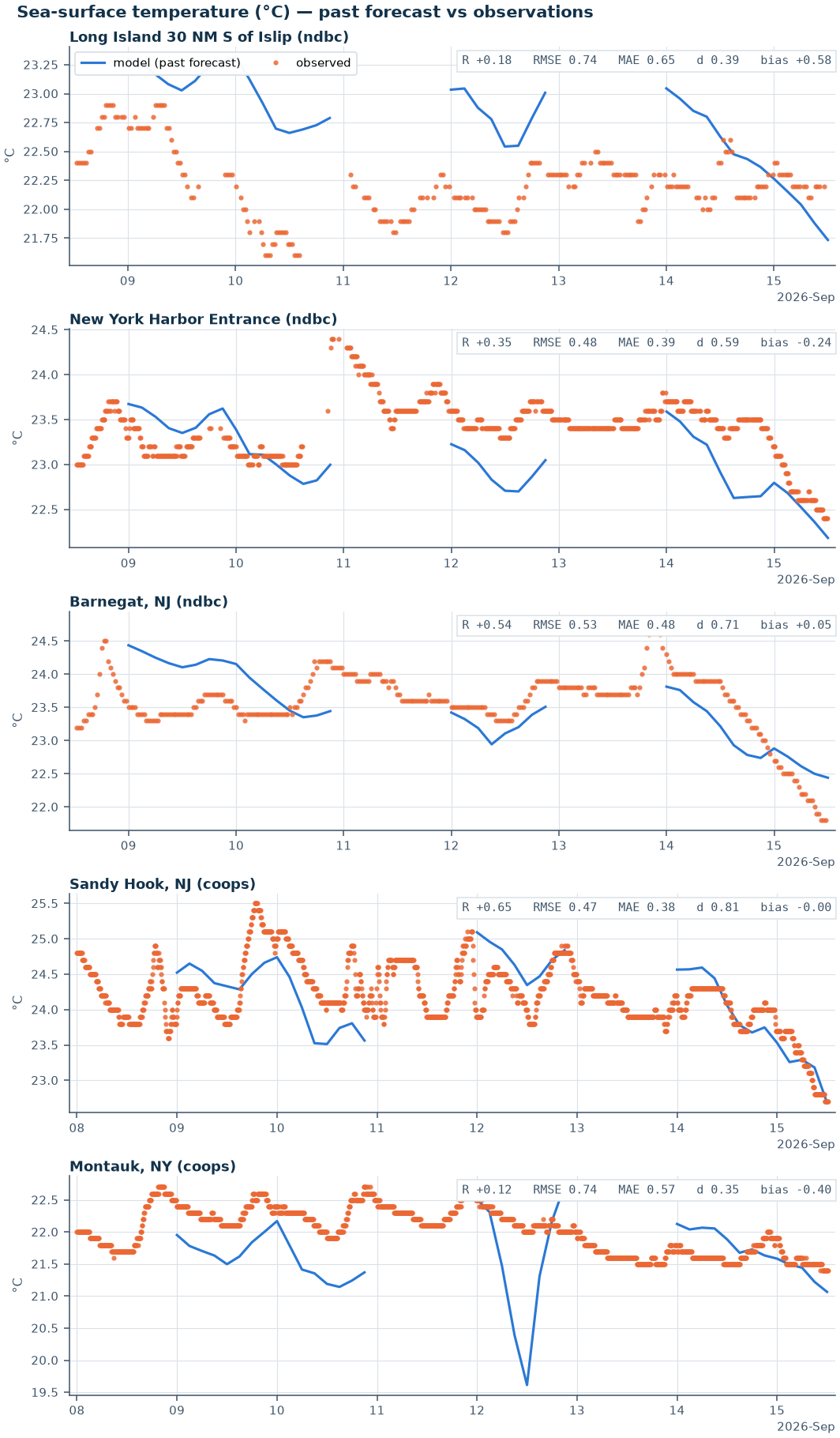 Daily skill check — modeled sea-surface temperature against five NDBC/CO-OPS stations. Correlation ranges from 0.12 to 0.65 — noticeably weaker than the water-level and current skill, and an area tracked for ongoing improvement.
No wave forecasting is included in this system — ROMS runs circulation only, without a coupled wave model.